Current Weather Outlook
Statewide weather outlook from Florida Division of Emergency Management Meteorology
Sunday, June 14, 2026
...Widespread Showers and Thunderstorms Expected Today Throughout the Peninsula and Northern Florida... Marginal Risk (Level 1 of 4) for Flash Flooding Outlooked Across the Eastern Half of Peninsula... Any Storm Could Produce Lightning and Heavy Downpours...Heat Ramps Up Across the Big Bend and Panhandle Today; Heat Advisory in Effect this Afternoon Across Central and Eastern Panhandle... Feels-like Temperatures in the Middle to Upper 100s Today... Seasonable Heat Expected Elsewhere Statewide... Moderate to High Risk for Rip Currents Along Panhandle and East Coast Beaches... Weak Disturbance Currently Inland in Mexico Not Expected to Develop Into a Tropical System (20% chance)...
Updated at 9:50 AM EDT
Today's Threats:
|
No Threat |
Low Threat |
Medium Threat |
High Threat |
|
Lightning |
Tornado |
Damaging Wind/Hail |
Wildfire |
Excessive Heat |
Flash Flooding |
Fog (Overnight) |
Rip Currents |
|
Eastern Panhandle Peninsula West Coast & Western Panhandle
|
|
Iso. Northeast Florida |
Iso. Statewide |
Big Bend & Eastern Panhandle Statewide |
East Coast |
|
Locally Panhandle East Coast & Panhandle West Coast & Gold Coast |

Weather Summary for the Next 24 Hours:
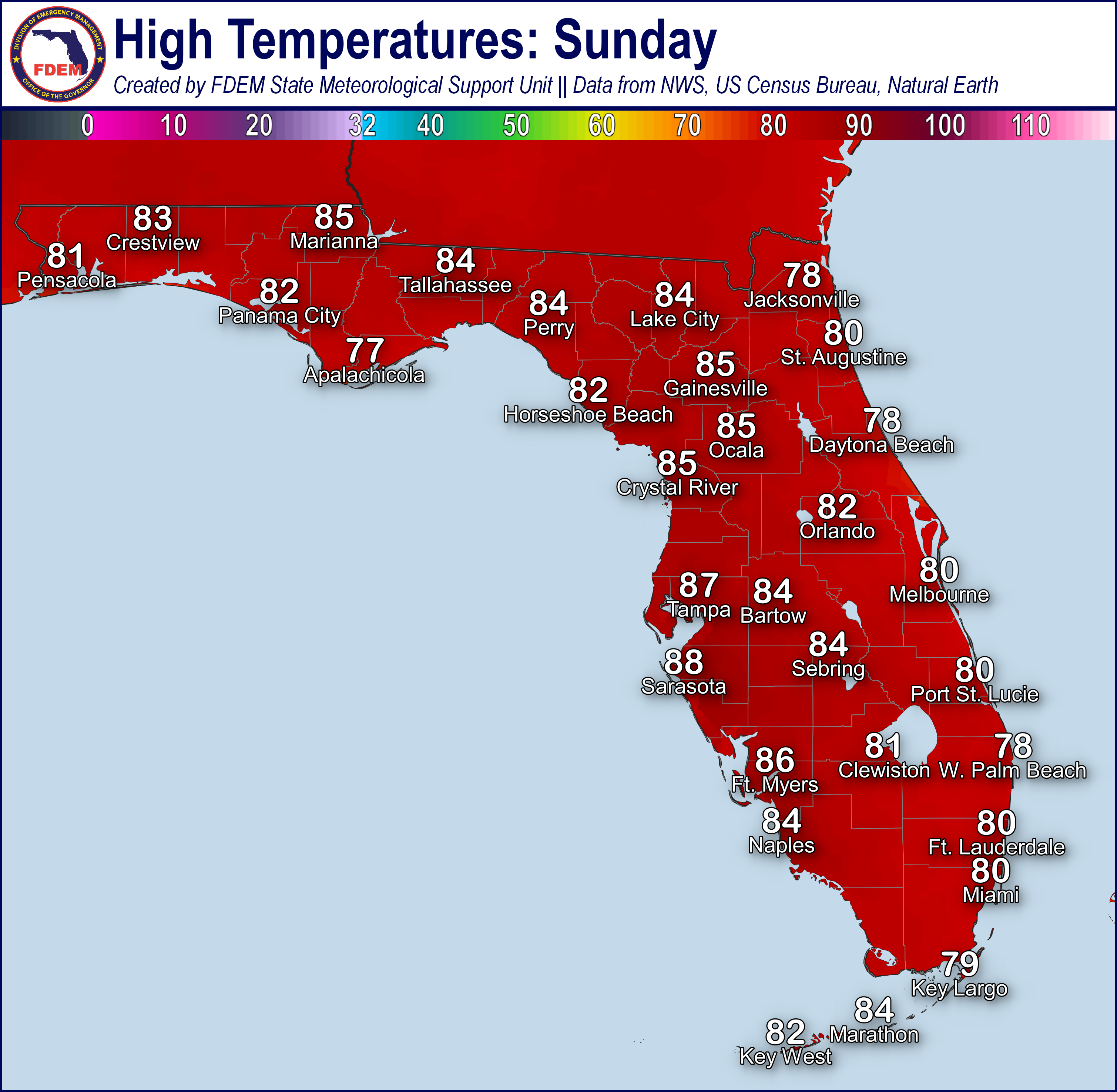
Yet another day of oppressive heat and humidity is expected today across much of the state. A Heat Advisory is once again in effect throughout the Big Bend and eastern Panhandle this afternoon until 6 PM EDT where daytime high temperatures soaring into the middle to upper 90s will bring heat indices into the middle to upper 100s. Throughout the rest of the state, highs are expected to reach into the lower to middle 90s with feels-like temperatures just below heat advisory criteria in the upper 90s to middle 100s.
A very similar distribution of afternoon showers and storms to yesterday is expected today. The richly moist airmass overtop the state promoting the hot and humid conditions will also result in scattered to widespread shower and thunderstorm activity throughout much of the Peninsula and Big Bend this afternoon (50-70% chance of rain). The highest coverage of storms will likely be within the Eastern Panhandle and Northeast Florida where the greatest moisture exists. A secondary maximum of coverage of afternoon storm coverage is expected within interior Southeast Florida (40-60% chance of rain).
Typical sea-breeze interactions and eventual outflow boundary collisions are expected to be the primary forcing mechanism for today’s activity. The majority of today’s activity will be sub-severe, but there is a chance for some locally strong storms capable of producing frequent lightning and gusty winds (40-50 mph). Portions of extreme northern Nassau County are within a Marginal Risk (level 1 of 5) for Severe Weather this afternoon where the greatest chance for damaging thunderstorm gusts exists. Additionally, this activity is expected to be slow-moving with embedded locally heavy downpours which may lead to instances of nuisance flooding and ponding of water in urban and poor drainage locations. A Marginal Risk (level 1 of 4) for Flash Flooding is outlooked throughout the East Coast where recent heavy rainfalls makes these areas especially vulnerable to flash flooding.
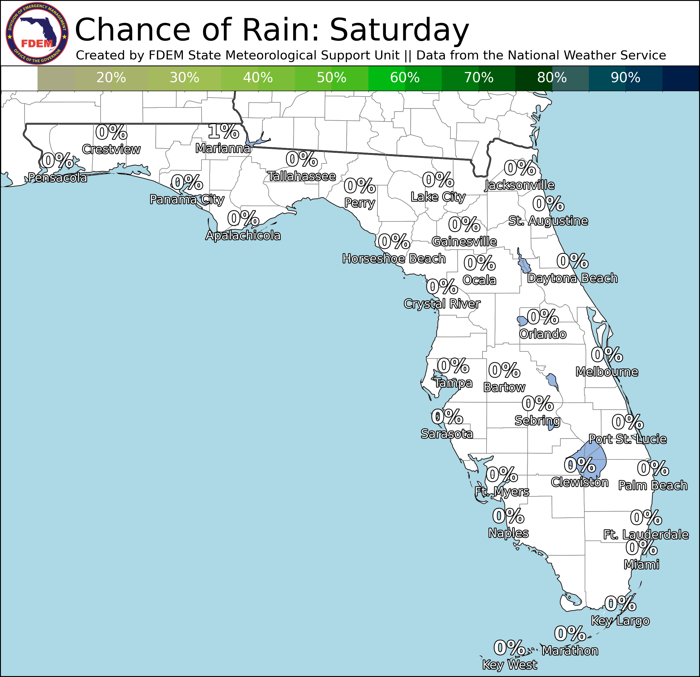
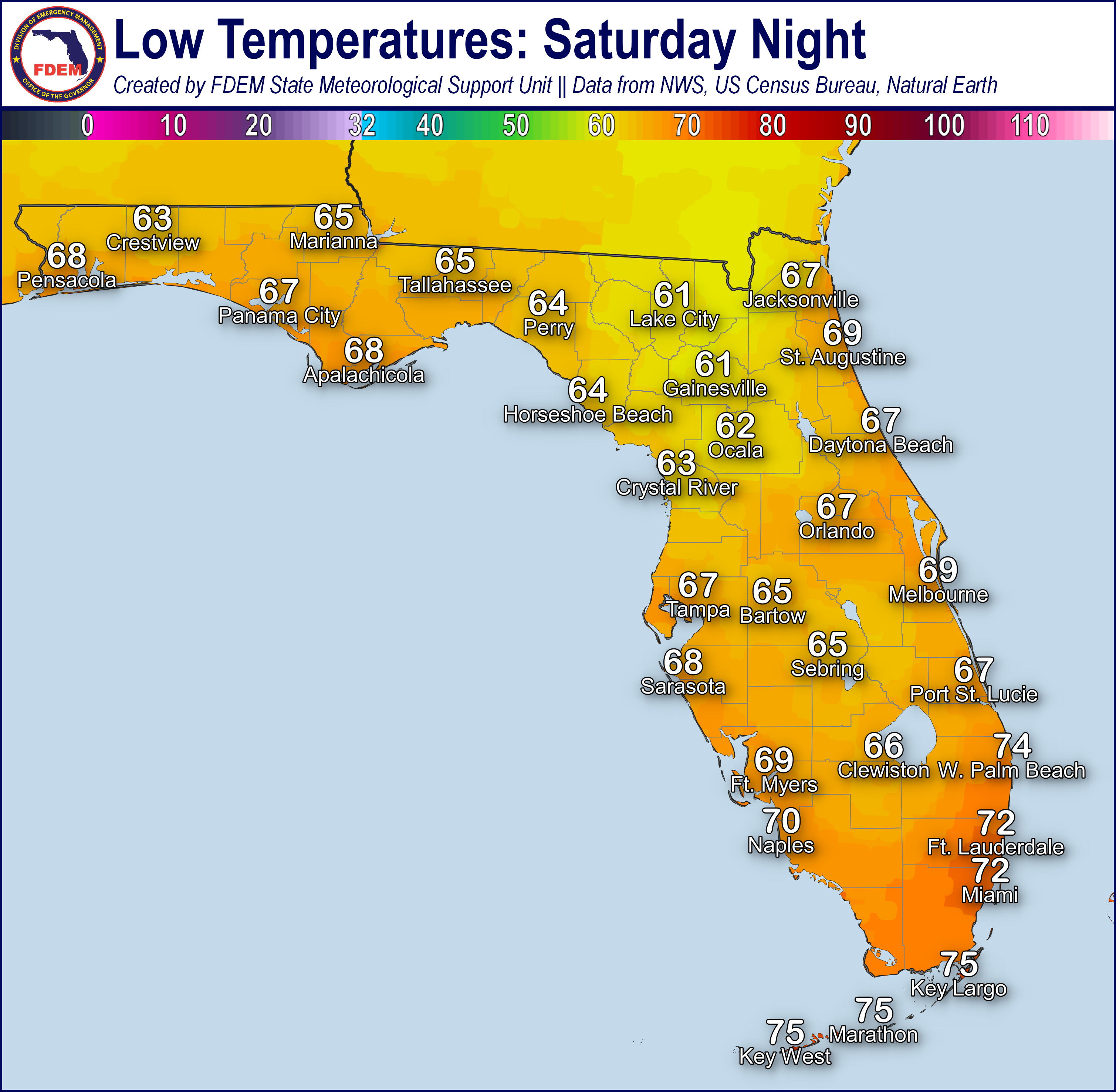
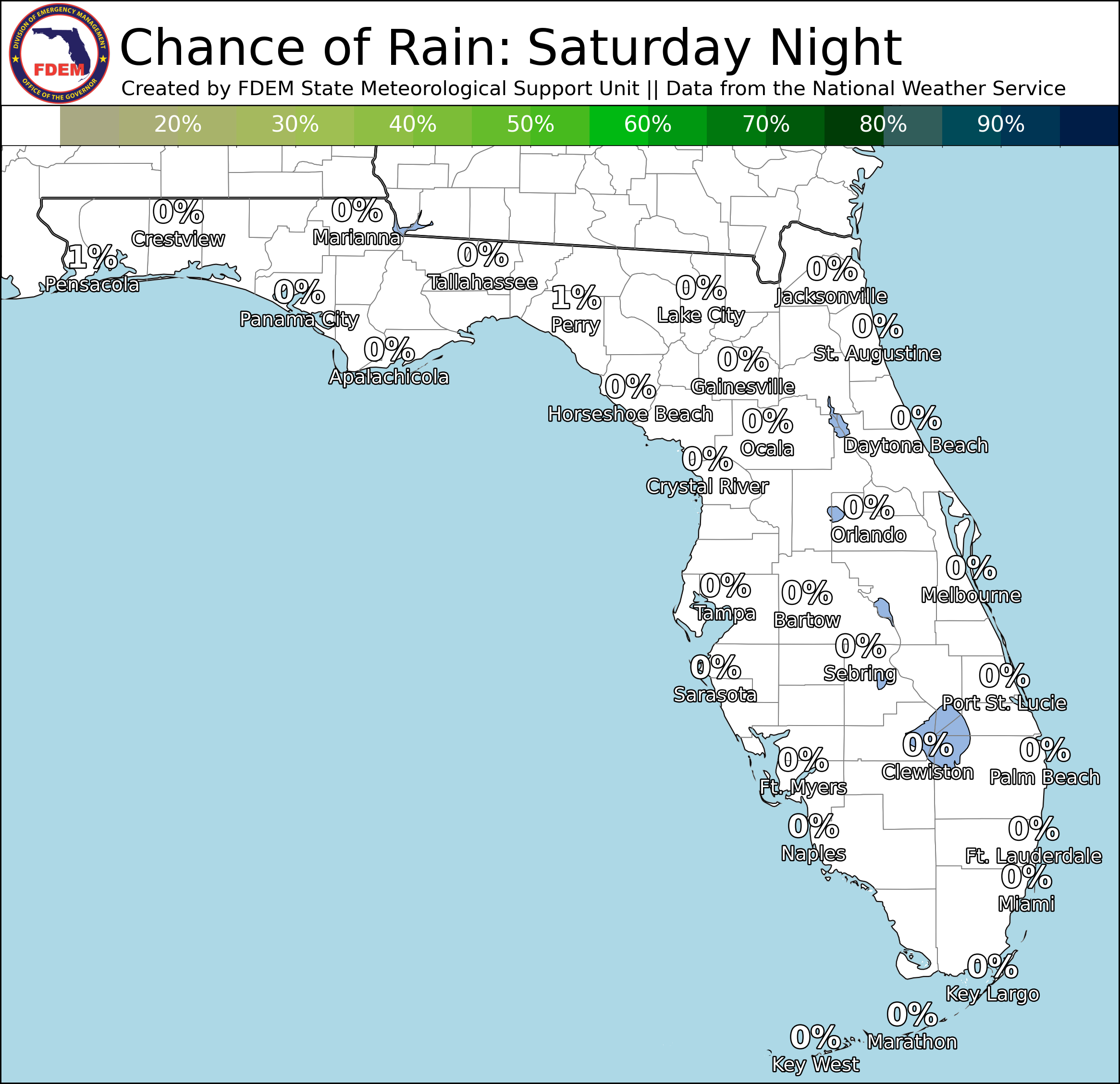
Tonight, shower and thunderstorm activity will linger into the evening hours, especially across the East Coast, before dissipating around midnight (25-50% chance of rain). Lows will only fall into the middle 70s to lower 80s tonight, bringing little relief from the daytime heat.

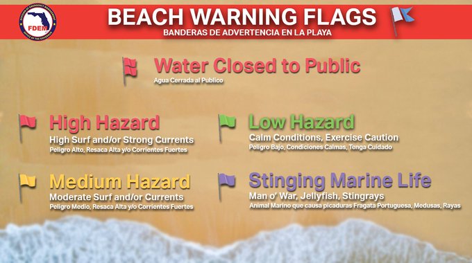
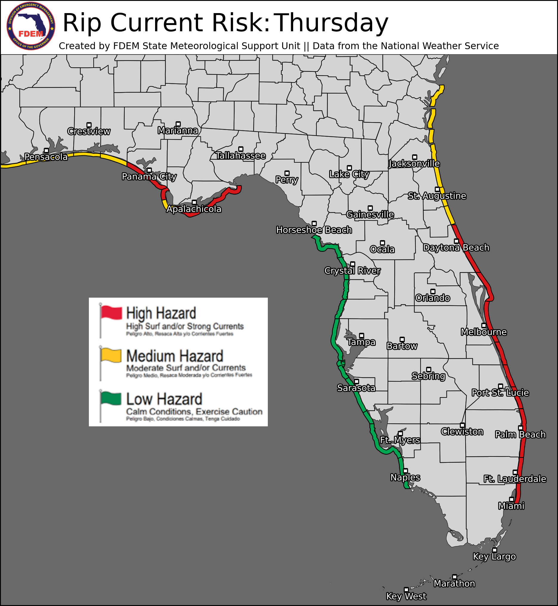
Rip Currents: Onshore winds will increase along the Panhandle coast today where a moderate to high risk for rip currents is expected for all beaches. A moderate risk persists for most East Coast beaches as well. A low risk is expected for Southeast Florida and the West Coast. For the latest Rip Current Outlook, visit www.weather.gov/beach.
Marine Hazards: Surf will be at 1-3’ for all statewide beaches today.
Red Tide: was observed at background concentrations offshore Taylor County over the past week. It was not observed elsewhere across the state (valid 6/12/26).
Coastal Flooding: There is no risk for coastal flooding today.

Fire Weather: A seasonably moist airmass remains in place over the state, keeping minimum relative humidity values well above critical thresholds today. Scattered to widespread showers and storms are expected today, primarily within the Big Bend, Northeast Florida, and the eastern half of the Florida Peninsula and along sea-breeze boundaries. Any of today’s thunderstorm activity may be accompanied by lightning and brief gusty/erratic winds. Recent hot and dry weather combined with long-term drought conditions will promote at least locally sensitive wildfire conditions statewide, especially with the risk of lightning-based ignitions. According to the Florida Forest Service, there are 52 active wildfires across the state burning approximately 5,665 acres.
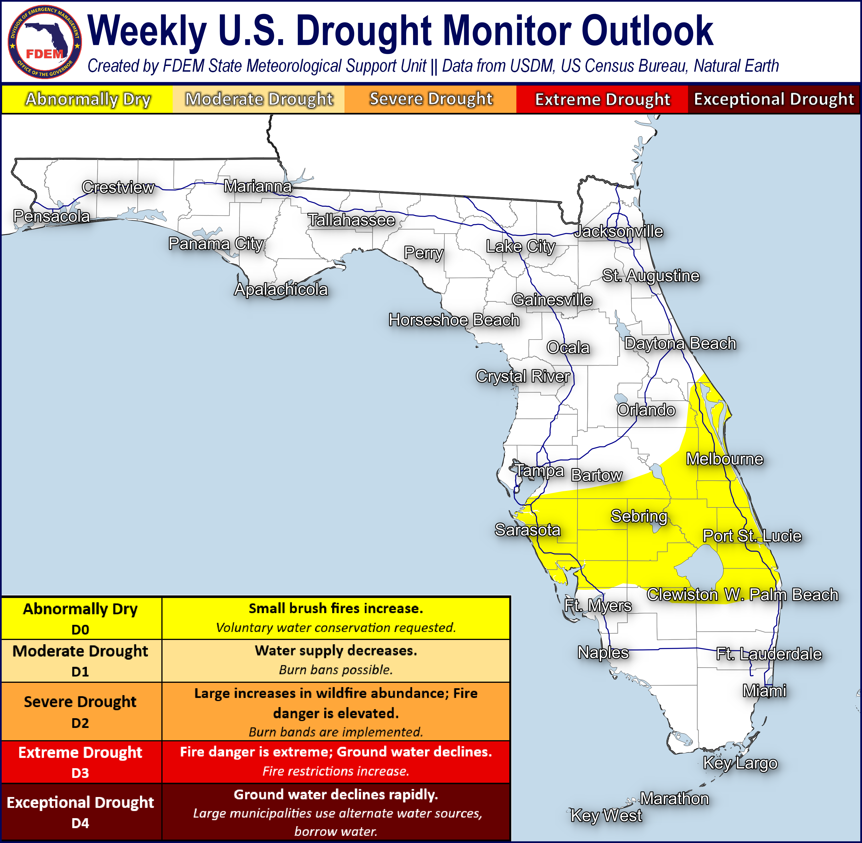
Drought (6/9/26): Additional improvements were made on this week’s Drought Monitor update throughout much of the state with the recent wet pattern bringing beneficial rainfall. Across portions of the northern and far western Panhandle, areas of moderate drought have been reduced to abnormally dry (receding drought) conditions on this week’s update. These areas have seen rainfall departures 8-10 inches above normal since the beginning of May which has quickly brought an end to the worst drought conditions. Many areas in the severe drought (level 2 of 4) to exceptional drought (level 4 of 4) across the Big Bend and Northeast Florida have also seen one or even two category drought reductions with recent rainfall over the past month. The areas of exceptional drought (level 4 of 4) are now found in localized pockets of the Suwannee River Valley and along the Forgotten Coast. The heaviest rainfall in the past 7 days was observed across South Florida and along the I-95 corridor. Many of these areas have also seen one category of drought reduction after receiving 1-3” of rainfall, or more, since last week. Localized pockets of extreme drought (level 3 of 4) remain across West Central and interior South Florida due to the scattered nature of recent thunderstorm activity. In general, however, much of the I-75 corridor has been reduced to a severe drought (level 2 of 4) with 30-day rainfall departures returning closer to normal or even above normal. Drought conditions along the immediate Southeast Coast continue to lessen with abnormally dry conditions (receding drought) expanding. 95% of Florida remains in at least moderate drought, with only ~4% of the state under exceptional drought – a 6% reduction in exceptional drought coverage compared to last week. Looking ahead, drier conditions will prevail throughout North Florida to end this week before a wetter pattern returns this weekend and to start next week. Scattered shower and thunderstorm activity will continue to favor the Peninsula with daily sea breeze activity, which will bring additional drought improvements.
The Keetch-Byram Drought Index average for Florida is 417 (-3) on a scale from 0 (very wet) to 800 (very dry). There are 9 out of 67 Florida counties that have an average KBDI above 500 (drought/increased fire danger).


Flash Flooding: A Marginal Risk (level 1 of 4) for Flash Flooding has been outlooked throughout the East Coast today where moist, tropical air will promote the development of slow-moving heavy thunderstorms along the sea breeze boundaries. These storms may lead to instances of nuisance flooding and ponding of water in urban and poor-drainage locations. Rainfall amounts will generally remain at our below 1” for most locations, however locally higher totals upwards of 2-4” are possible.
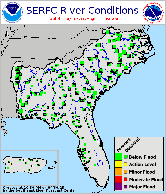
Riverine Flooding: There are no riverine concerns across the state. For more information, visit the River Forecast Center.
Lake Okeechobee’s average elevation is 11.05 feet, which is within the operational band and is 2.13 feet below normal for this time of year.